
Ramdania topographic map
Interactive map
Click on the map to display elevation.
About this map
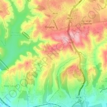
Name: Ramdania topographic map, elevation, terrain.
Location: Ramdania, Douera, Daïra Draria, Alger, 16049, Algérie (36.63949 2.92395 36.67949 2.96395)
Average elevation: 453 ft
Minimum elevation: 151 ft
Maximum elevation: 745 ft