
上赛巴村 topographic map
Interactive map
Click on the map to display elevation.
About this map
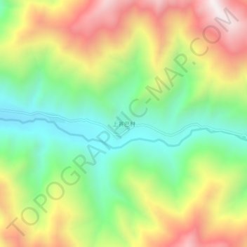
Name: 上赛巴村 topographic map, elevation, terrain.
Location: 上赛巴村, Chindu County, Yushu, Qinghai, China (32.98032 97.27851 33.02032 97.31851)
Average elevation: 13,287 ft
Minimum elevation: 11,768 ft
Maximum elevation: 15,299 ft