
Lutty topographic map
Interactive map
Click on the map to display elevation.
About this map
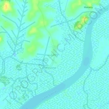
Name: Lutty topographic map, elevation, terrain.
Average elevation: 16 ft
Minimum elevation: -7 ft
Maximum elevation: 75 ft
Other topographic maps
Click on a map to view its topography, its elevation and its terrain.
Malambay
Sierra Leone > Kambia District > Yenkesa
Malambay, Yenkesa, Kambia District, North West Province, Sierra Leone, Sierra Leone
Average elevation: 43 ft
Ropet
Sierra Leone > Kambia District > Makompa > Ropet
Ropet, Makompa, Kambia District, North Western Province, Sierra Leone
Average elevation: 10 ft