
Duggingen topographic map
Interactive map
Click on the map to display elevation.
About this map
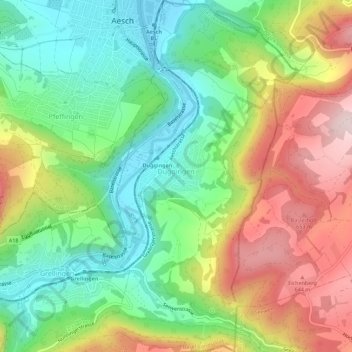
Name: Duggingen topographic map, elevation, terrain.
Location: Duggingen, Bezirk Laufen, Bâle-Campagne, 4202, Suisse (47.43270 7.59393 47.47045 7.62607)
Average elevation: 1,519 ft
Minimum elevation: 978 ft
Maximum elevation: 2,310 ft
Other topographic maps
Click on a map to view its topography, its elevation and its terrain.
Schloss Angenstein
Suisse > Bâle-Campagne > Bezirk Laufen > Duggingen
Schloss Angenstein, Aeschstrasse, Duggingen, Bezirk Laufen, Bâle-Campagne, 4202, Suisse
Average elevation: 1,263 ft
Laufon
Suisse > Bâle-Campagne > Bezirk Laufen
Laufon, Bezirk Laufen, Bâle-Campagne, 4242, Suisse
Average elevation: 1,493 ft