
Valleuse du Curé topographic map
Interactive map
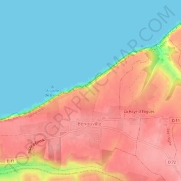
Click on the map to display elevation.
About this map
Name: Valleuse du Curé topographic map, elevation, terrain.
Average elevation: 157 ft
Minimum elevation: 0 ft
Maximum elevation: 335 ft
Other topographic maps
Click on a map to view its topography, its elevation and its terrain.
Château de Bénouville
France > Normandie > Bénouville
Château de Bénouville, Le Château, Bénouville, Caen, Calvados, Normandie, France métropolitaine, 14970, France
Average elevation: 46 ft