
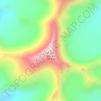
Mount Igikpak topographic map
Interactive map
Click on the map to display elevation.
About this map
Name: Mount Igikpak topographic map, elevation, terrain.
Location: Mount Igikpak, Northwest Arctic, Alaska, United States (67.41261 -154.96478 67.41271 -154.96468)
Average elevation: 5,669 ft
Minimum elevation: 4,281 ft
Maximum elevation: 8,281 ft
Other topographic maps
Click on a map to view its topography, its elevation and its terrain.
Buckland
United States > Alaska > Northwest Arctic
Buckland, Northwest Arctic, Alaska, 99727, United States
Average elevation: 30 ft
Noatak
United States > Alaska > Northwest Arctic
Noatak, Northwest Arctic, Alaska, United States
Average elevation: 102 ft
Kotzebue
United States > Alaska > Northwest Arctic
Kotzebue, Northwest Arctic, Alaska, United States
Average elevation: 30 ft
Red Dog Mine
United States > Alaska > Northwest Arctic
Red Dog Mine, Northwest Arctic, Alaska, United States
Average elevation: 1,033 ft