
Überherrn topographic map
Interactive map
Click on the map to display elevation.
About this map
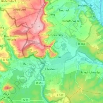
Name: Überherrn topographic map, elevation, terrain.
Location: Überherrn, Landkreis Saarlouis, Saarland, 66802, Duitsland (49.21521 6.66009 49.30452 6.76246)
Average elevation: 801 ft
Minimum elevation: 571 ft
Maximum elevation: 1,240 ft
Other topographic maps
Click on a map to view its topography, its elevation and its terrain.
Nalbach
Duitsland > Saarland > Landkreis Saarlouis
Nalbach, Landkreis Saarlouis, Saarland, 66809, Duitsland
Average elevation: 827 ft
Lebach
Duitsland > Saarland > Landkreis Saarlouis
Lebach, Landkreis Saarlouis, Saarland, 66822, Duitsland
Average elevation: 968 ft
Schmelz
Duitsland > Saarland > Landkreis Saarlouis
Schmelz, Landkreis Saarlouis, Saarland, 66839, Duitsland
Average elevation: 951 ft