
Erlaufstausee topographic map
Interactive map
Click on the map to display elevation.
About this map
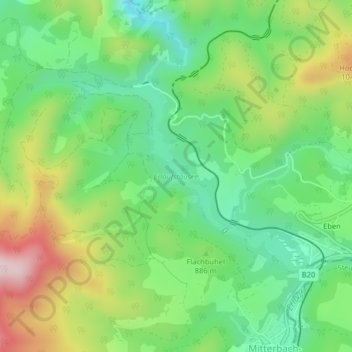
Name: Erlaufstausee topographic map, elevation, terrain.
Average elevation: 2,838 ft
Minimum elevation: 2,320 ft
Maximum elevation: 3,717 ft
Other topographic maps
Click on a map to view its topography, its elevation and its terrain.
Gemeinde Mitterbach am Erlaufsee
Österreich > Niederösterreich > Gemeinde Mitterbach am Erlaufsee
Gemeinde Mitterbach am Erlaufsee, Bezirk Lilienfeld, Niederösterreich, 3224, Österreich
Average elevation: 3,278 ft
Ötscherbach
Österreich > Niederösterreich > Gemeinde Mitterbach am Erlaufsee
Ötscherbach, Gemeinde Mitterbach am Erlaufsee, Bezirk Lilienfeld, Niederösterreich, Österreich
Average elevation: 3,058 ft