
Messinghausen topographic map
Interactive map
Click on the map to display elevation.
About this map
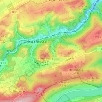
Name: Messinghausen topographic map, elevation, terrain.
Average elevation: 1,542 ft
Minimum elevation: 1,089 ft
Maximum elevation: 2,041 ft
Other topographic maps
Click on a map to view its topography, its elevation and its terrain.
Petersborn
Duitsland > Noordrijn-Westfalen > Hochsauerlandkreis > Brilon > Petersborn
Petersborn, Brilon, Hochsauerlandkreis, Noordrijn-Westfalen, 59929, Duitsland
Average elevation: 1,722 ft
Gudenhagen
Duitsland > Noordrijn-Westfalen > Hochsauerlandkreis > Brilon
Gudenhagen, Brilon, Hochsauerlandkreis, Noordrijn-Westfalen, 59929, Duitsland
Average elevation: 1,680 ft