Le Bois d'Âne topographic map
Interactive map
Click on the map to display elevation.
About this map
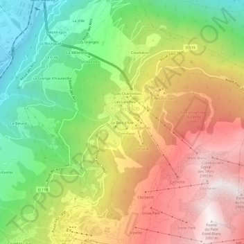
Name: Le Bois d'Âne topographic map, elevation, terrain.
Average elevation: 5,217 ft
Minimum elevation: 2,559 ft
Maximum elevation: 8,123 ft

Click on the map to display elevation.
Name: Le Bois d'Âne topographic map, elevation, terrain.
Average elevation: 5,217 ft
Minimum elevation: 2,559 ft
Maximum elevation: 8,123 ft