
Ingoyghem topographic map
Interactive map
Click on the map to display elevation.
About this map
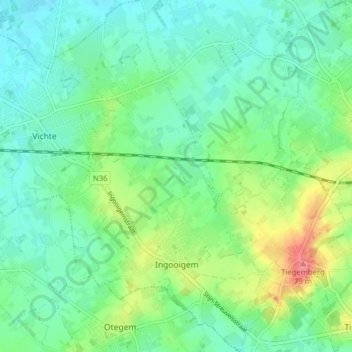
Name: Ingoyghem topographic map, elevation, terrain.
Location: Ingoyghem, Anzegem, Flandre-Occidentale, Flandre, Belgique (50.80504 3.40755 50.85471 3.45764)
Average elevation: 102 ft
Minimum elevation: 33 ft
Maximum elevation: 266 ft