
Thank you for supporting this site ❤️
Make a donation
Make a donation
Gear up for your next adventure:
As an Amazon Associate, this site earns from qualifying purchases at no extra cost to you.
Conocoto topographic map
Click on the map to display elevation.
Thank you for supporting this site ❤️
Make a donation
Make a donation
Gear up for your next adventure:
As an Amazon Associate, this site earns from qualifying purchases at no extra cost to you.
About this map
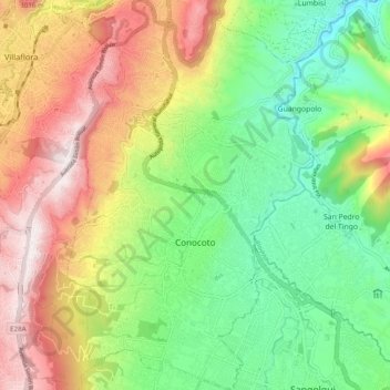
Name: Conocoto topographic map, elevation, terrain.
Location: Conocoto, Quito Canton, Pichincha, Ecuador (-0.32913 -78.50993 -0.23148 -78.44818)
Average elevation: 8,760 ft
Minimum elevation: 7,546 ft
Maximum elevation: 10,443 ft
Thank you for supporting this site ❤️
Make a donation
Make a donation
Gear up for your next adventure:
As an Amazon Associate, this site earns from qualifying purchases at no extra cost to you.