
Asnæs topographic map
Interactive map
Click on the map to display elevation.
About this map
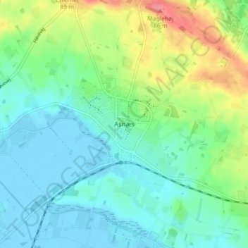
Name: Asnæs topographic map, elevation, terrain.
Location: Asnæs, Odsherred Municipality, Region Zealand, 4550, Denmark (55.79482 11.48064 55.83482 11.52064)
Average elevation: 75 ft
Minimum elevation: -23 ft
Maximum elevation: 276 ft