
Jagodina topographic map
Interactive map
Click on the map to display elevation.
About this map
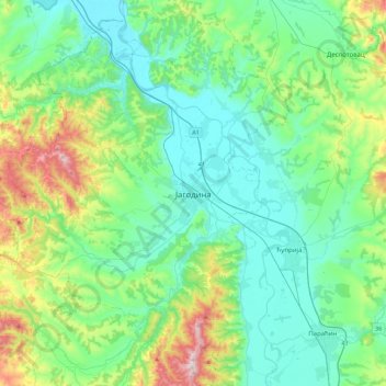
Name: Jagodina topographic map, elevation, terrain.
Average elevation: 761 ft
Minimum elevation: 325 ft
Maximum elevation: 2,290 ft
Other topographic maps
Click on a map to view its topography, its elevation and its terrain.
Ribare
Serbia > Central Serbia > Pomoravlje Administrative District
Ribare, City of Jagodina, Pomoravlje Administrative District, Central Serbia, 35219, Serbia
Average elevation: 374 ft