
京都市 topographic map
Interactive map
Click on the map to display elevation.
About this map
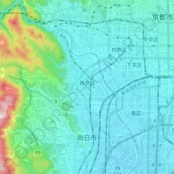
Name: 京都市 topographic map, elevation, terrain.
Location: 西京区, 京都市, Prefectura de Kioto, 近畿地方, Japón (34.92726 135.59931 35.03060 135.72211)
Average elevation: 299 ft
Minimum elevation: 33 ft
Maximum elevation: 1,959 ft