
Nadiya topographic map
Interactive map
Click on the map to display elevation.
About this map
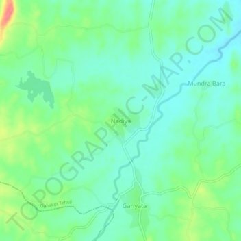
Name: Nadiya topographic map, elevation, terrain.
Location: Nadiya, Galiakot Tehsil, Dungarpur District, Rajasthan, India (23.48245 73.94125 23.52245 73.98125)
Average elevation: 486 ft
Minimum elevation: 417 ft
Maximum elevation: 650 ft
Other topographic maps
Click on a map to view its topography, its elevation and its terrain.
Bhemai
India > Rajasthan > Galiakot Tehsil
Bhemai, Galiakot Tehsil, Dungarpur District, Rajasthan, India
Average elevation: 614 ft
Silohi
India > Rajasthan > Galiakot Tehsil
Silohi, Galiakot Tehsil, Dungarpur District, Rajasthan, 314026, India
Average elevation: 459 ft
Daiyana
India > Rajasthan > Galiakot Tehsil
Daiyana, Galiakot Tehsil, Dungarpur District, Rajasthan, India
Average elevation: 525 ft