
Saint John topographic map
Interactive map
Click on the map to display elevation.
About this map
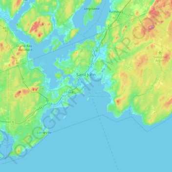
Name: Saint John topographic map, elevation, terrain.
Location: Saint John, Saint John County, Neubraunschweig, Kanada (45.14150 -66.23940 45.37693 -65.83886)
Average elevation: 128 ft
Minimum elevation: -26 ft
Maximum elevation: 732 ft
Other topographic maps
Click on a map to view its topography, its elevation and its terrain.
Saint John
Kanada > Neubraunschweig > Saint John
Saint John, City of Saint John, Saint John County, Neubraunschweig, E2L 3L6, Kanada
Average elevation: 144 ft