
目梨郡 topographic map
Interactive map
Click on the map to display elevation.
About this map
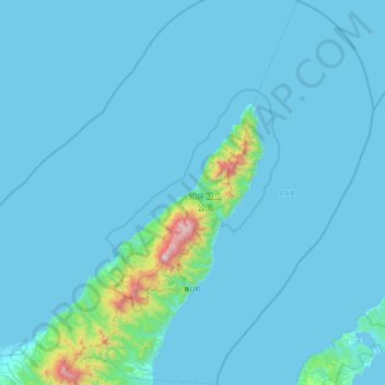
Name: 目梨郡 topographic map, elevation, terrain.
Location: 羅臼町, 目梨郡, 根室振興局, Prefectura de Hokkaidō, 北海道地方, Japón (43.85156 144.87676 44.52711 145.63750)
Average elevation: 246 ft
Minimum elevation: 0 ft
Maximum elevation: 5,322 ft
Other topographic maps
Click on a map to view its topography, its elevation and its terrain.