
Aguaviva topographic map
Interactive map
Click on the map to display elevation.
About this map
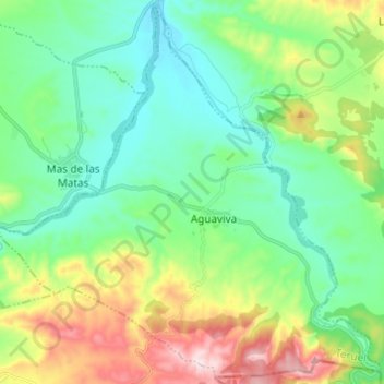
Name: Aguaviva topographic map, elevation, terrain.
Location: Aguaviva, Bajo Aragón, Teruel, Aragón, España (40.78446 -0.26625 40.87363 -0.14453)
Average elevation: 1,909 ft
Minimum elevation: 1,453 ft
Maximum elevation: 3,015 ft