
Stichtse Vecht topographic map
Interactive map
Click on the map to display elevation.
About this map
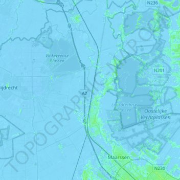
Name: Stichtse Vecht topographic map, elevation, terrain.
Location: Stichtse Vecht, Utrecht, Netherlands (52.11672 4.90964 52.28932 5.12053)
Average elevation: -3 ft
Minimum elevation: -26 ft
Maximum elevation: 20 ft
Other topographic maps
Click on a map to view its topography, its elevation and its terrain.
Nigtevecht
Netherlands > Utrecht > Stichtse Vecht
Nigtevecht, Stichtse Vecht, Utrecht, Netherlands
Average elevation: -3 ft