
Anniviers topographic map
Interactive map
Click on the map to display elevation.
About this map
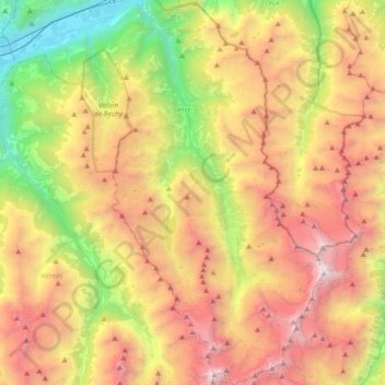
Name: Anniviers topographic map, elevation, terrain.
Location: Anniviers, Sierre, Valais/Wallis, 3961, Switzerland (46.02733 7.51513 46.27971 7.71614)
Average elevation: 7,579 ft
Minimum elevation: 1,611 ft
Maximum elevation: 14,596 ft
Other topographic maps
Click on a map to view its topography, its elevation and its terrain.
Zinalrothorn
Switzerland > Valais/Wallis > Anniviers
Zinalrothorn, Anniviers, Sierre, Valais/Wallis, 3961, Switzerland
Average elevation: 11,529 ft