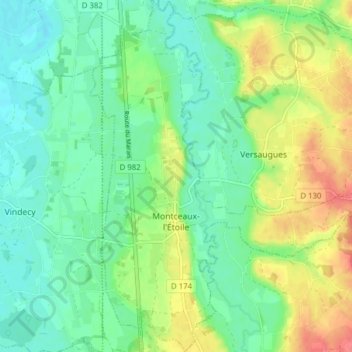
Montceaux-l'Étoile topographic map
Interactive map
Click on the map to display elevation.
About this map
Name: Montceaux-l'Étoile topographic map, elevation, terrain.
Average elevation: 840 ft
Minimum elevation: 768 ft
Maximum elevation: 974 ft

Click on the map to display elevation.
Name: Montceaux-l'Étoile topographic map, elevation, terrain.
Average elevation: 840 ft
Minimum elevation: 768 ft
Maximum elevation: 974 ft