
Las Grutas topographic map
Interactive map
Click on the map to display elevation.
About this map
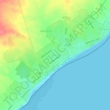
Name: Las Grutas topographic map, elevation, terrain.
Location: Las Grutas, Departamento San Antonio, Río Negro, Argentina (-40.82484 -65.11094 -40.78748 -65.05619)
Average elevation: 75 ft
Minimum elevation: 0 ft
Maximum elevation: 246 ft