
雾浓顶 topographic map
Interactive map
Click on the map to display elevation.
About this map
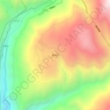
Name: 雾浓顶 topographic map, elevation, terrain.
Location: 雾浓顶, 升平镇, 德钦县, 迪庆藏族自治州, 云南省, 中国 (28.42575 98.89698 28.46575 98.93698)
Average elevation: 10,748 ft
Minimum elevation: 8,327 ft
Maximum elevation: 13,307 ft
Other topographic maps
Click on a map to view its topography, its elevation and its terrain.