
Alcalá de los Gazules topographic map
Interactive map
Click on the map to display elevation.
About this map
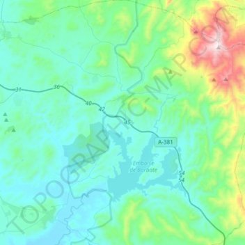
Name: Alcalá de los Gazules topographic map, elevation, terrain.
Average elevation: 610 ft
Minimum elevation: 30 ft
Maximum elevation: 3,540 ft
Other topographic maps
Click on a map to view its topography, its elevation and its terrain.
Arroyo de San Ambrosio
Spanje > Andalusië > La Janda > Vejer de la Frontera
Arroyo de San Ambrosio, Vejer de la Frontera, Barbate, La Janda, Cádiz, Andalusië, 11159, Spanje
Average elevation: 20 ft