
Thank you for supporting this site ❤️
Make a donation
Make a donation
Gear up for your next adventure:
As an Amazon Associate, this site earns from qualifying purchases at no extra cost to you.
Tennenlohe topographic map
Click on the map to display elevation.
Thank you for supporting this site ❤️
Make a donation
Make a donation
Gear up for your next adventure:
As an Amazon Associate, this site earns from qualifying purchases at no extra cost to you.
About this map
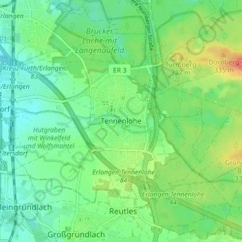
Name: Tennenlohe topographic map, elevation, terrain.
Location: Tennenlohe, Erlangen, Bavaria, 91058, Germany (49.52929 11.00413 49.56929 11.04413)
Average elevation: 988 ft
Minimum elevation: 925 ft
Maximum elevation: 1,106 ft
Thank you for supporting this site ❤️
Make a donation
Make a donation
Gear up for your next adventure:
As an Amazon Associate, this site earns from qualifying purchases at no extra cost to you.