
Thank you for supporting this site ❤️
Make a donation
Make a donation
Gear up for your next adventure:
As an Amazon Associate, this site earns from qualifying purchases at no extra cost to you.
Kitwe topographic map
Click on the map to display elevation.
Thank you for supporting this site ❤️
Make a donation
Make a donation
Gear up for your next adventure:
As an Amazon Associate, this site earns from qualifying purchases at no extra cost to you.
About this map
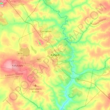
Name: Kitwe topographic map, elevation, terrain.
Location: Kitwe, Kitwe District, Copperbelt Province, 1001, Zambia (-12.98037 28.05560 -12.66037 28.37560)
Average elevation: 4,045 ft
Minimum elevation: 3,780 ft
Maximum elevation: 4,364 ft
Thank you for supporting this site ❤️
Make a donation
Make a donation
Gear up for your next adventure:
As an Amazon Associate, this site earns from qualifying purchases at no extra cost to you.