
Converse topographic map
Interactive map
Click on the map to display elevation.
About this map
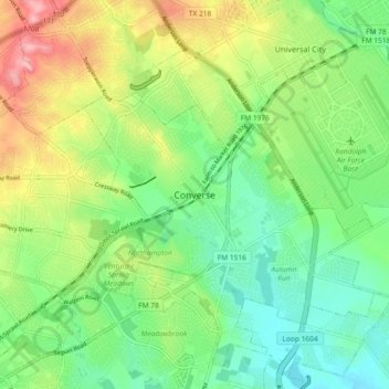
Name: Converse topographic map, elevation, terrain.
Location: Converse, Bexar County, Texas, 78109, United States (29.47801 -98.35612 29.55801 -98.27612)
Average elevation: 755 ft
Minimum elevation: 600 ft
Maximum elevation: 1,024 ft