
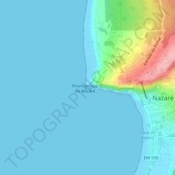
Forte de São Miguel Arcanjo topographic map
Interactive map
Click on the map to display elevation.
About this map
Name: Forte de São Miguel Arcanjo topographic map, elevation, terrain.
Average elevation: 59 ft
Minimum elevation: -7 ft
Maximum elevation: 423 ft
Other topographic maps
Click on a map to view its topography, its elevation and its terrain.
Praia da Nazaré
Praia da Nazaré, Nazaré, Leiria, Portugal
Average elevation: 121 ft
Praia do Norte
Praia do Norte, Nazaré, Leiria, Portugal
Average elevation: 118 ft