Geolocate

福都 topographic map

Interactive map

Click on the map to display elevation.

About this map

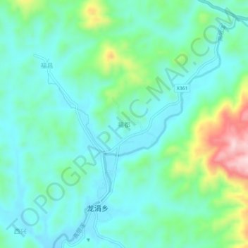
Name: 福都 topographic map, elevation, terrain.

Location: 福都, 安溪县, 泉州市, 福建省, 中国 (24.95427 117.71629 24.99427 117.75629)

Average elevation: 2,146 ft

Minimum elevation: 1,909 ft

Maximum elevation: 2,913 ft

Other topographic maps

Click on a map to view its topography, its elevation and its terrain.

蓝田乡

中国 > 福建省 > 安溪县

蓝田乡, 安溪县, 泉州市, 福建省, 中国

Average elevation: 2,201 ft

西坪镇

中国 > 福建省 > 安溪县

西坪镇, 安溪县, 泉州市, 福建省, 中国

Average elevation: 1,923 ft

湖头镇

中国 > 福建省 > 安溪县

湖头镇, 安溪县, 泉州市, 福建省, 中国

Average elevation: 968 ft

安溪县

中国 > 福建省 > 安溪县

安溪县, 泉州市, 福建省, 362400, 中国

Average elevation: 984 ft

閩南

中国 > 福建省 > 安溪县 > 虎邱镇

閩南, 虎邱镇, 安溪县, 泉州市, 福建省, 中国

Average elevation: 1,234 ft