
Զվարթնոց օդանավակայան topographic map
Interactive map
Click on the map to display elevation.
About this map
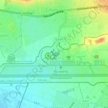
Name: Զվարթնոց օդանավակայան topographic map, elevation, terrain.
Location: Զվարթնոց օդանավակայան, Armavir Province, Armenia (40.14971 44.39328 40.15570 44.40660)
Average elevation: 2,828 ft
Minimum elevation: 2,779 ft
Maximum elevation: 2,920 ft