
Thank you for supporting this site ❤️
Make a donation
Make a donation
Gear up for your next adventure:
As an Amazon Associate, this site earns from qualifying purchases at no extra cost to you.
Kłodzko topographic map
Click on the map to display elevation.
Thank you for supporting this site ❤️
Make a donation
Make a donation
Gear up for your next adventure:
As an Amazon Associate, this site earns from qualifying purchases at no extra cost to you.
About this map
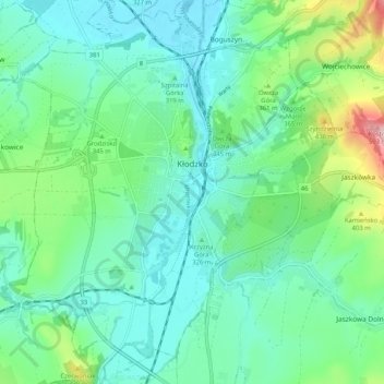
Name: Kłodzko topographic map, elevation, terrain.
Location: Kłodzko, Kłodzko County, Lower Silesian Voivodeship, Poland (50.40098 16.60397 50.46651 16.69410)
Average elevation: 1,073 ft
Minimum elevation: 915 ft
Maximum elevation: 1,368 ft
Thank you for supporting this site ❤️
Make a donation
Make a donation
Gear up for your next adventure:
As an Amazon Associate, this site earns from qualifying purchases at no extra cost to you.