
Río Turia topographic map
Interactive map
Click on the map to display elevation.
About this map
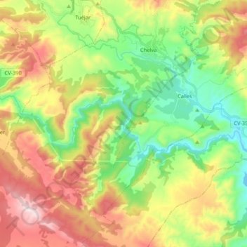
Name: Río Turia topographic map, elevation, terrain.
Average elevation: 2,116 ft
Minimum elevation: 971 ft
Maximum elevation: 3,763 ft
Other topographic maps
Click on a map to view its topography, its elevation and its terrain.
Villar de Tejas
España > Comunidad Valenciana > Chelva > Villar de Tejas
Villar de Tejas, Chelva, Los Serranos, Valencia, Comunidad Valenciana, 46351, España
Average elevation: 3,120 ft