
Pic du Marboré topographic map
Interactive map
Click on the map to display elevation.
About this map
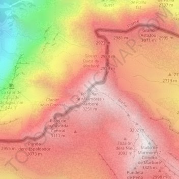
Name: Pic du Marboré topographic map, elevation, terrain.
Location: Pic du Marboré, Bielsa, Sobrarbe, Huesca, Aragon, Espagne (42.69278 0.01160 42.69288 0.01170)
Average elevation: 8,973 ft
Minimum elevation: 5,230 ft
Maximum elevation: 10,850 ft
Other topographic maps
Click on a map to view its topography, its elevation and its terrain.