
Silberborn topographic map
Interactive map
Click on the map to display elevation.
About this map
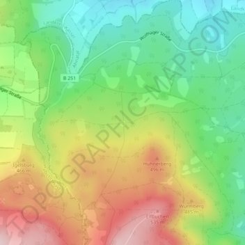
Name: Silberborn topographic map, elevation, terrain.
Location: Silberborn, Harleshausen, Kassel, Hessen, 36292, Duitsland (51.32996 9.37714 51.34996 9.39714)
Average elevation: 1,312 ft
Minimum elevation: 906 ft
Maximum elevation: 1,854 ft
Other topographic maps
Click on a map to view its topography, its elevation and its terrain.
Nord (Holland)
Nord (Holland), Kassel, Hessen, 34109, Duitsland
Average elevation: 564 ft