
Brivezac topographic map
Interactive map
Click on the map to display elevation.
About this map
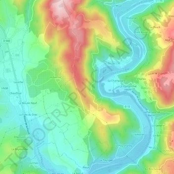
Name: Brivezac topographic map, elevation, terrain.
Average elevation: 810 ft
Minimum elevation: 476 ft
Maximum elevation: 1,486 ft
Other topographic maps
Click on a map to view its topography, its elevation and its terrain.
Beaulieu-sur-Dordogne
Frankrijk > Nieuw-Aquitanië > Beaulieu-sur-Dordogne
Beaulieu-sur-Dordogne, Brive-la-Gaillarde, Corrèze, Nieuw-Aquitanië, Metropolitaans Frankrijk, 19120, Frankrijk
Average elevation: 771 ft