
Hampteau topographic map
Interactive map
Click on the map to display elevation.
About this map
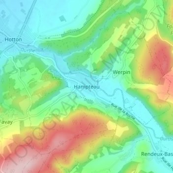
Name: Hampteau topographic map, elevation, terrain.
Location: Hampteau, Luxemburg, Wallonië, 6990, België (50.23790 5.45290 50.27790 5.49290)
Average elevation: 817 ft
Minimum elevation: 568 ft
Maximum elevation: 1,316 ft