
Armadouro topographic map
Interactive map
Click on the map to display elevation.
About this map
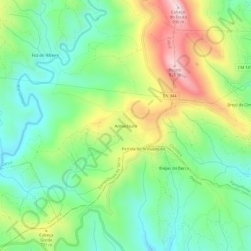
Name: Armadouro topographic map, elevation, terrain.
Location: Armadouro, Cabril, Pampilhosa da Serra, Coimbra, Portugal (40.04242 -7.88372 40.08242 -7.84372)
Average elevation: 2,018 ft
Minimum elevation: 1,447 ft
Maximum elevation: 3,031 ft