
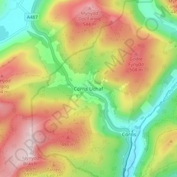
Corris Uchaf topographic map
Interactive map
Click on the map to display elevation.
About this map
Name: Corris Uchaf topographic map, elevation, terrain.
Location: Corris Uchaf, Gwynedd, Wales, SY20 9BP, United Kingdom (52.64296 -3.87804 52.68296 -3.83804)
Average elevation: 1,010 ft
Minimum elevation: 194 ft
Maximum elevation: 1,932 ft
Other topographic maps
Click on a map to view its topography, its elevation and its terrain.
Llyn Cau
United Kingdom > Wales > Corris Uchaf
Llyn Cau, Minffordd Path, Corris Uchaf, Gwynedd, Wales, LL36 9AJ, United Kingdom
Average elevation: 1,821 ft