
Birkenwerder topographic map
Interactive map
Click on the map to display elevation.
About this map
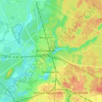
Name: Birkenwerder topographic map, elevation, terrain.
Location: Birkenwerder, Oberhavel, Brandenburg, 16547, Germany (52.68095 13.24453 52.72649 13.36637)
Average elevation: 151 ft
Minimum elevation: 98 ft
Maximum elevation: 220 ft