
Cañi topographic map
Interactive map
Click on the map to display elevation.
About this map
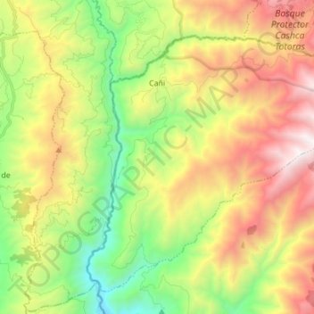
Name: Cañi topographic map, elevation, terrain.
Location: Cañi, Colta, Chimborazo, Ecuador (-1.86722 -79.02293 -1.74761 -78.88299)
Average elevation: 9,281 ft
Minimum elevation: 5,810 ft
Maximum elevation: 13,875 ft