
Arradon topographic map
Interactive map
Click on the map to display elevation.
About this map
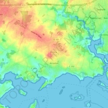
Name: Arradon topographic map, elevation, terrain.
Average elevation: 66 ft
Minimum elevation: -3 ft
Maximum elevation: 194 ft
Arradon liegt am Golf von Morbihan, fünf Kilometer von Vannes und 43 Kilometer von Lorient entfernt auf einer Höhe zwischen null und 61 m über dem Meer.