
powiat łomżyński topographic map
Interactive map
Click on the map to display elevation.
About this map
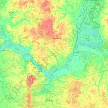
Name: powiat łomżyński topographic map, elevation, terrain.
Location: powiat łomżyński, Woiwodschaft Podlachien, Polen (52.97873 21.62257 53.43785 22.49838)
Average elevation: 423 ft
Minimum elevation: 302 ft
Maximum elevation: 722 ft