Geolocate

Rustington topographic map

Click on the map to display elevation.

About this map

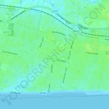
Name: Rustington topographic map, elevation, terrain.

Location: Rustington, Arun, West Sussex, England, United Kingdom (50.80124 -0.52277 50.82275 -0.48940)

Average elevation: 16 ft

Minimum elevation: 0 ft

Maximum elevation: 33 ft

Other topographic maps

Click on a map to view its topography, its elevation and its terrain.

Harrow Hill

United Kingdom > England > West Sussex > Arun

Average elevation: 348 ft

Felpham

United Kingdom > England > West Sussex > Arun > Felpham

Average elevation: 7 ft

Gear up for your next adventure:

📻Weather Alert Radios - Stay informed of storm risks while off-the-grid
🌧️Backpack Rain Cover - Keep gear dry in wet weather
🔪Outdoor Multitools - Essential survival tools for gear repair and field use
🛌Ultralight Sleeping Bags - Compact down bags for cold nights in the wilderness
🕶️GPS Smartphone Mount - Secure mount for phone navigation

As an Amazon Associate, this site earns from qualifying purchases at no extra cost to you.