
Bukoba topographic map
Interactive map
Click on the map to display elevation.
About this map
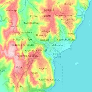
Name: Bukoba topographic map, elevation, terrain.
Location: Bukoba, Kagera, Lake Zone, Tanzanie (-1.38807 31.76643 -1.26129 31.85814)
Average elevation: 3,990 ft
Minimum elevation: 3,698 ft
Maximum elevation: 4,514 ft
Other topographic maps
Click on a map to view its topography, its elevation and its terrain.