
Thank you for supporting this site ❤️
Make a donation
Make a donation
Gear up for your next adventure:
As an Amazon Associate, this site earns from qualifying purchases at no extra cost to you.
Arzerè topographic map
Click on the map to display elevation.
Thank you for supporting this site ❤️
Make a donation
Make a donation
Gear up for your next adventure:
As an Amazon Associate, this site earns from qualifying purchases at no extra cost to you.
About this map
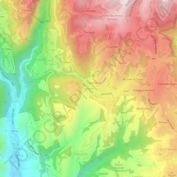
Name: Arzerè topographic map, elevation, terrain.
Location: Arzerè, Bosco Chiesanuova, Verona, Veneto, 37021, Italy (45.56899 10.99486 45.60899 11.03486)
Average elevation: 2,119 ft
Minimum elevation: 955 ft
Maximum elevation: 3,235 ft
Thank you for supporting this site ❤️
Make a donation
Make a donation
Gear up for your next adventure:
As an Amazon Associate, this site earns from qualifying purchases at no extra cost to you.