
Stari Ledinci topographic map
Interactive map
Click on the map to display elevation.
About this map
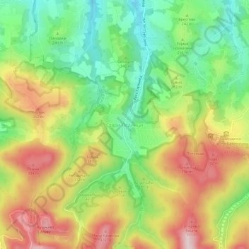
Name: Stari Ledinci topographic map, elevation, terrain.
Average elevation: 837 ft
Minimum elevation: 338 ft
Maximum elevation: 1,447 ft
Other topographic maps
Click on a map to view its topography, its elevation and its terrain.
Ravno Selo
Serbia > Vojvodina > South Backa Administrative District > Vrbas Municipality
Ravno Selo, Vrbas Municipality, South Backa Administrative District, Vojvodina, Serbia
Average elevation: 269 ft