
دهستان لای سیاه topographic map
Interactive map
Click on the map to display elevation.
About this map
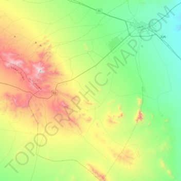
Name: دهستان لای سیاه topographic map, elevation, terrain.
Average elevation: 6,266 ft
Minimum elevation: 4,606 ft
Maximum elevation: 9,633 ft
Other topographic maps
Click on a map to view its topography, its elevation and its terrain.
زندوان
Iran > Isfahan Province > Nain County > دهستان بافران > زندوان
زندوان, دهستان بافران, بخش مرکزی, Nain County, Isfahan Province, Iran
Average elevation: 5,062 ft