
Quartier Centre-Ville topographic map
Interactive map
Click on the map to display elevation.
About this map
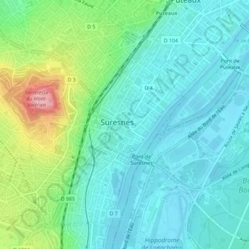
Name: Quartier Centre-Ville topographic map, elevation, terrain.
Average elevation: 197 ft
Minimum elevation: 85 ft
Maximum elevation: 545 ft
Other topographic maps
Click on a map to view its topography, its elevation and its terrain.
Quartier Écluse-Belvédère
France > Île-de-France > Suresnes
Quartier Écluse-Belvédère, Suresnes, Nanterre, Hauts-de-Seine, Île-de-France, France métropolitaine, 92150, France
Average elevation: 194 ft