
Trasadingen topographic map
Interactive map
Click on the map to display elevation.
About this map
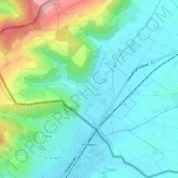
Name: Trasadingen topographic map, elevation, terrain.
Location: Trasadingen, Bezirk Unterklettgau, Schaffhouse, 8219, Suisse (47.65387 8.40558 47.68388 8.44915)
Average elevation: 1,457 ft
Minimum elevation: 1,306 ft
Maximum elevation: 1,909 ft